


 English
 Français
  Português


 Pas de réaction
 Comment!


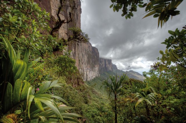
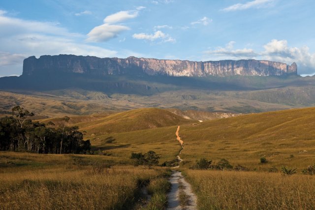
This is the first time I have ever felt the cold in Guiana. At an altitude of 2,800 metres the first rays of the sun just barely warm our layers of winter clothing. Mount Roraima allows us to contemplate its kingdom for a few moments, the Guiana Highlands of Venezuela. At my feet a vast cliff marks the southern face of the Tepui*, and in the distance the Gran Sabana* stretches out as far as the eye can see, with gigantic plateaux scattered here and there. Is it here that the mystery of the Guianas came to be?
A few weeks earlier I was in Caracas. The Venezuelan capital is often described as a den of thieves, but is this reputation deserved? Or does it suffer from a warped image due to the goings-on of its populist Marxist President, Hugo Chávez?
The first person I speak with is a friendly taxi driver, one of the many Colombians working in the country, a land of opportunity for the bold thanks to its dynamic economy boosted by oil.
The megalopolis of nearly 5,000,000 inhabitants is abuzz with activity. A cacophony of sirens and horns sounds out from the improbably dense traffic (petrol being virtually free here). Now and then a military convoy made up of a motley assortment of Japanese motorbikes, pick-ups, and brand-new trucks appears, sirens blaring. The petrostate of Venezuela does not do things by half when it comes to its army, an inexhaustible source of employment.
The inhabitants defend strongly diverging political opinions. “Chávez does a lot to help the poor,” according to one Afro-American immigrant from Trinidad who survives in the capital by juggling several different jobs. “It’s an economic catastrophe for the country,” a tour agent observes. It is hard to form your own opinion given the clearly demarcated battle lines drawn up for and against the socialist revolution of the government of the Bolivarian Republic of Venezuela. The whole capital is busy preparing for the bicentenary of the revolution and is bedecked in the colours of this historic anniversary. Gigantic frescoes have been painted on the walls of the town to deliver a single message: President Chávez’s revolution is the worthy heir of the revolution of Bolivar.
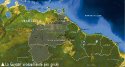
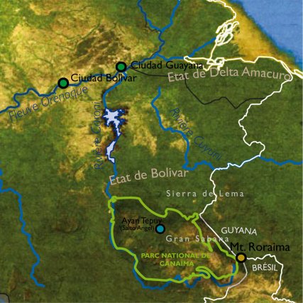
It is in the province of Bolivar lying to the south of the Orinoco that my border lies, that of the Guiana Highlands of Venezuela making up half the surface of the country yet home to only 6% of its population, who are predominantly Amerindian here.
It takes ten or so hours by road to reach this part of the country. Luckily Venezuelan coaches are comfortable and cheap. Caracas coach station is on the same scale as the rest of the town. A permanent cloud of diesel floats in the air and infernal quantities of coaches come and go in a deafening din.
The town of Ciudad Guayana on the banks of the Orinoco is the gateway to this part of the country. But “Guyana city”, along with its 800,000 inhabitants, does not live up to its evocative name. Built less than fifty years ago alongside the old historic town of San Felix, which it has virtually absorbed, the town is a vast metalworking industrial complex linked up by vast motorways. The Caroni river, which rises in the Guiana Highlands, here flows into the black waters of the Orinoco. Its hydroelectric power is much sought-after and the State holding company, the Venezuelan Corporation of Guiana, has built many dams along it which produce nearly half the electricity of the country. The town does not have any real centre, just giant shopping malls, and it seems to be prey to a frenzy of consumerism. Is this the development model for the region?
The road to Ciudad Bolivar is a six-lane highway running alongside the Orinoco. A taxi takes us there in less than one hour, driving flat-out. Here history asserts itself. The great river is once again at the heart of the city and is edged by narrow little alleys flanked with old buildings telling of the past grandeur of the town. It was founded in 1595 and used to be called Santo Tomé de la Guyana. It has seen hordes of explorers pass through looking for Manoa. In the nineteenth century Simon Bolivar put it on a map by leading his revolution there. Nowadays money and power seem to have moved away and the inhabitants live to the peaceful rhythm of the past. It is no longer necessary to go further up the river to get to the Highlands as a magnificent road has now been built.
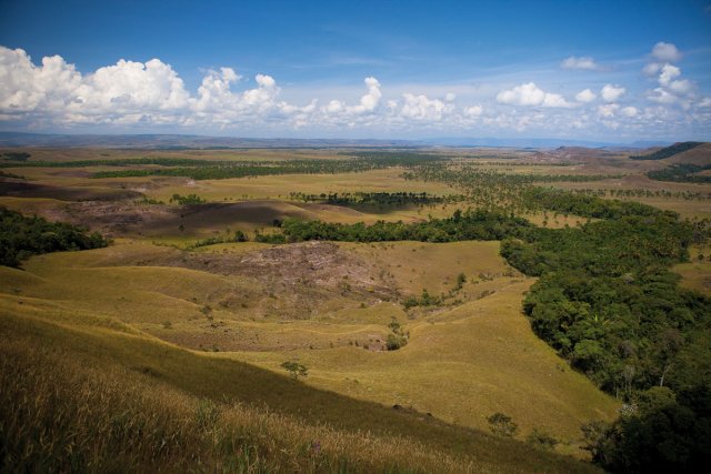
It heads due South cutting through a vegetation gradient reflecting the amount of rainfall. From the Orinoco it runs in a straight line for about 250 kilometres through a landscape made up of a mosaic of forests and savannahs modelled by man. 90% of the 1.5 million inhabitants of the Guyana Highlands of Venezuela live in this relatively dry zone. Then it is the beginning of the Sierra de Lema with its evocatively named village of El Dorado. For the next 70 kilometres the forest is greener and taller and the road climbs up from an attitude of 150 to 1,440 metres over the Sierra to the site of “La Escalera” through denser forest cover, the cloud forest. Here the rain caused by the trade winds encountering the mountain gives rise to the Cuyuni, a great tributary of the Essequibo in Guyana. At the top the road comes out onto the Gran Sabana* plateau, a vast territory at nearly 1,000 metres above sea level covered in a patchwork of savannahs, wet meadowlands, and large-leafed vegetation with many rapateaceae, bromeliaceae, cyperaceae, shrubs, and fragments of forest. The periodic fires lit by the Amerindian communities maintain this typical herbaceous vegetation in this state. At last a wooden sign by the edge of the road marks an invisible boundary, that of Canaima National Park.
Santa Helena is the last town before Brazil. Built in the middle of the savannah it is a port of call for all hikers heading for Mount Roraima, the only Tepui* you can get to by foot and the highest and most popular of them.
The walk to the plateau starts from a little Amerindian village called Paratepuy (in the Pemon language tepuy means mountain). You can already admire the two tabletop mountains standing opposite one another in the distance, Mount Kukenan and Mount Roraima. These sandstone mountains are what remain of vast sedimentary plateaux dating from the pre-Cambrian period nearly 4 billion years ago, and are recognised as the oldest formations on the planet. They are the relics of a mineral age when life was trying to emerge in bacterial form.
The trekking company organising my climb does not leave anything to chance. Several guides come with us (Marco, a Pemon Amerindian born near Guyana, and Roberto, a Turaran Amerindian born in Brazil), as well as full logistical support in the form of a tent, kitchen, and even portable toilets. Canaima National Park seeks to impose stringent conditions on walkers to preserve the site, which is overrun in the high season.
Our approach to the tepui* is mesmerising. With every step we become more aware of its immensity and its details.
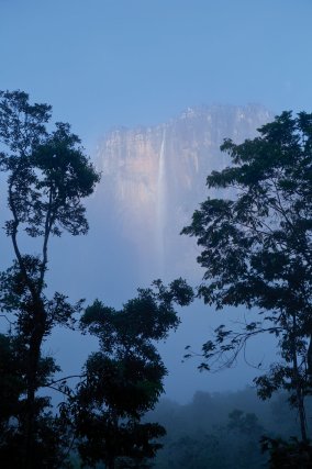
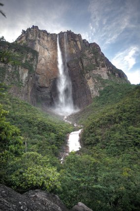
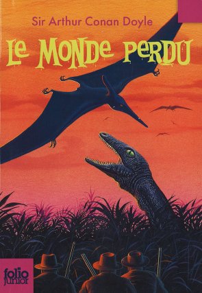
After a two-day walk we arrive at the foot of the mountain. Clouds from the North rain heavily on our cosmopolitan team (including a Venezuelan, two Australians, two Indians, a Japanese tourist, and the Pemon guides). A few minutes later we come across waterfalls evacuating the excess water from the top of the plateau. We are at the foot of the “lost world” imagined by Conan Doyle in the nineteenth century. The light is fading and fog snakes around the gigantic fissures, enveloping the mountain, and making it look for all the world like some titanic ruin.
We start our climb at dawn. Our path starts off through what is almost a botanical garden of ferns, flowers, orchids, and then bromeliaceae and palm trees making up an extraordinarily diverse low-level forest. This is also “Bird land” and it is they who are the true masters of the place. Up until the last moment I keep a look-out for the way up to the top, the “ramp”. We stop in front of an implacable wall not far from a strange section of the mountain that collapsed at the dawn of time.
After the steep ascent nothing prepares you for the emotion of arriving at the summit.
The place seems to be ageless, and clouds come and go, revealing and concealing a predominantly mineral landscape with absurd and disturbing sculpted forms. In the distance, like on the edge of a mediaeval map, is the void. Sometimes between the clouds you can make out the world of the earthbound 1,000 metres below.
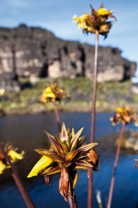
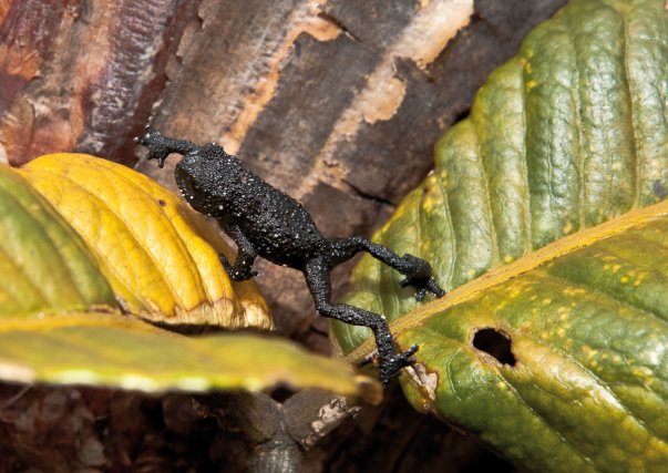
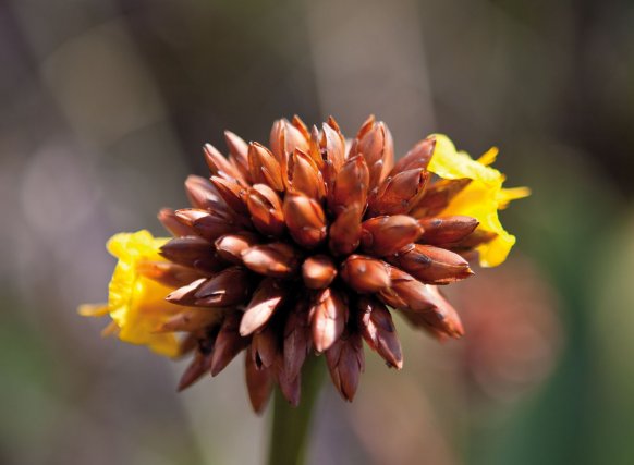
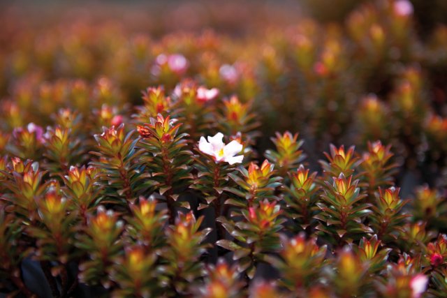
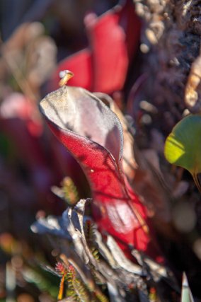
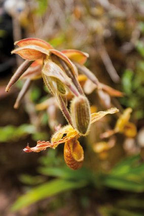
The peaks of these tepuis, between 2,500 and 3,000 metres above sea level, have highly endemic flora and ecological diversity. Between two rocks or on the banks of the stream are dense clumps of miniscule coloured flowers, many of them carnivorous, to make up for the low level of nitrogen in the soil.
Mount Roraima is not just a liminal world between the heavens and the earth, it also lies at the intersection of three nations: Brazil, Venezuela, and Guyana. To the north-east the tepui* overlooks the rainforest of the Guianas rather than the great Venezuelan savannah.
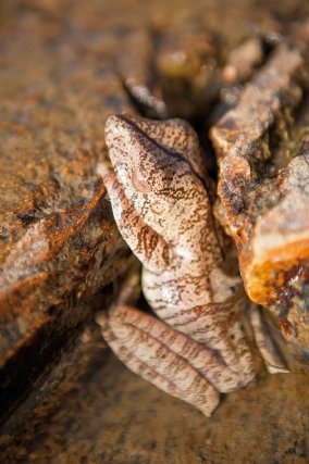
When this idea occurs to me I try to head off on my own to enjoy a new unique view of my adoptive country. There are no pathways across the black rock and you have to clamber over and around the rocks, leap, to go and spot the places where the crystals have been trampled underfoot, to notice a frog on an overhanging rock. And then fog descends on the place and my memory, wiping out the improvised map. Am I lost? It is as if the tepui* had given me a warning and is not going to give me a second chance. I head back, glad after all to have managed to scale this Olympus of the Guianas and come back safe and sound.
 Voyages avec Tooy. Histoire, mémoire, imaginaire des Amériques noires : Editions Vents d’ailleurs, 2010
 Guyane. Produits du terroir et recettes traditionnelles. L’inventaire du patrimoine culinaire de la France : Editions Albin Michel, 1999
 Alunawalé, un voyage à travers les milieux naturels de Guyane : Office National des Forêts, 2009
 Augusta Curiel, Fotografe in Suiriname 1904 – 1937 : Libri Misei Surinamensis, 2007