


 English
 Français
  Português


 Pas de réaction
 Comment!


Remote sensing techniques used to save the Amazonian environment
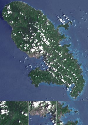
The situation in Amazonia and the urgent need to work with reliable environmental information have made it necessary for scientific research and sustainable development to be able to draw on cutting-edge tools. The Development Research Institute (IRD, Institut de Recherche pour le Développement) centre in French Guiana is in good shape thanks to the emergence of an international satellite centre monitoring the Amazonian environment.
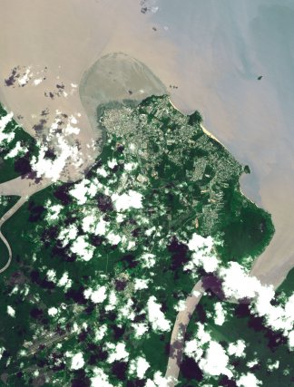
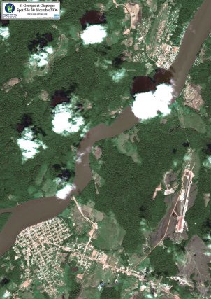
The first satellite image dates from November 2005 and since then the SEAS-Guyane station has been working flat out. Every day, between 200 and 550 images arrive in real time at the IRD centre in Cayenne. Thanks to this technological platform, over 140,000 images captured by the SPOT 2, 4 and 5 and ENVISAT satellites were catalogued in 2006.
The stated aim is to create an observatory and benchmark centre for knowledge and monitoring of the dynamics of the Amazonian and Caribbean environment, to provide a better knowledge of the ecosystems, and to make French Guiana more attractive for research and for training in remote sensing and its applications. The Cayenne ESPACE unit (Expertise et Spatialisation des Connaissances en Environnement) and Professor Jean-Marie Fotsing (the Head of the IRD centre in French Guiana) gave us access to the SEAS-Guyane technology. SEAS stands for Surveillance de l’Environnement amazonien Assistée par Satellite (satellite-assisted surveillance of the Amazonian environment).
Unique in the world
French Guiana is ideally placed for observing the Amazon and acts as a European window in the equatorial zone.
This is a boon for French Guiana, which for the past two years has had a technological platform that is unrivalled in either South America or in Europe – the SEAS-Guyane satellite image reception station. It was set up by the IRD, and its public funding came mainly from the French Guiana Region, the French National Centre for Space Studies (CNES, Centre National d’Etudes Spatiales), the State, and the European Regional Government Fund (ERDF). It also part of a public/private partnership between the IRD and the company Spot Image.
SEAS has a dual function
The SEAS station is an outstanding source of data for French Guiana and the territories within the image acquisition zone. The IRD and its partners have several objectives:
- To provide tools for research, for local authorities, and for innovative companies
- To develop high-quality teaching in remote sensing at the Guianese University Complex (Pôle Universitaire Guyanais, or PUG).
Regional and international scientific cooperation
Professor Fotsing stresses that “French Guiana is the only region in the world where the research community, the authorities, and people working in industry have access to free data”.
An executive committee examines requests and decides whether or not to release a satellite image on the basis of precise criteria. Will the project be of interest for the development of French Guiana? Is the scientific project based on sound premises? 702 images captured by SPOT were released in response to users’ needs in 2006.
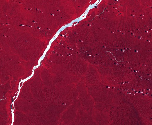
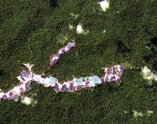
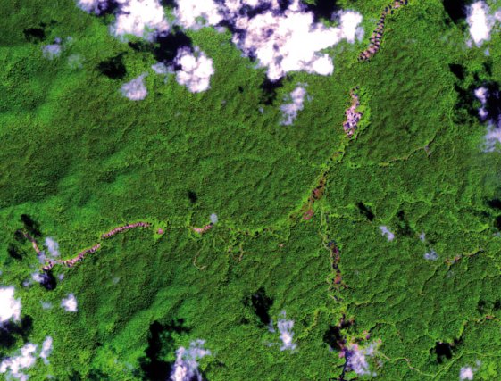
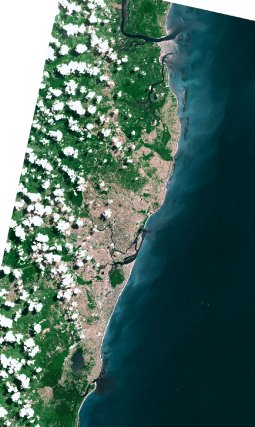
Remote sensing has many applications of differing sorts. SEAS-Guyane acts as an observatory for water resources, territorial dynamics, and biodiversity.
A few examples of projects show that a satellite image is a very useful tool in decision-making. In 2006 the Regional Directorate for the Environment (DIREN, Direction Régionale de l’Environnement) used satellite images to determine exactly where the inhabited zones were within the planned parameter of the Amazonian Park. The Region also used SPOT images to modify the broad lines of its Regional Planning Scheme (Schéma d’Aménagement Régional).
The activities of innovative companies such as Nev@ntropic make it possible to use these images to track hydrocarbon pollution or deforestation.
Images from SEAS-Guyane are central to major international projects
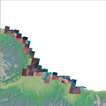
In July 2007 nearly 600 images were used for pilot projects carried out by the ESPACE unit. Professor Fotsing cites as an example the PARAGE project to help decide where best to locate agricultural activity, thanks primarily to better analysis of the impact agriculture has on the environment. The EREMIBA project relates to a wholly different domain, health. It seeks to study the relationships between changes in the environment and the way tropical diseases such as dengue and malaria spread. Finally the PROCLAM programme to map the Amazonian coast will make it possible to draw up a continuous map of the coast between Saint-Laurent-du-Maroni to the west and Sao Luis in the State of Maranhão (Brazil).
Developing training in remote sensing
One of the major objectives behind the establishment of the SEAS station in French Guiana was to develop training. The PUG (Guianese University Complex) needs to develop suitable post-baccalaureate training so that young Guianese people are able to make use of satellite imaging. “There is no basic training in geography” according to Professor Fotsing. In 2006 the first year-group arrived to study for a Master’s degree in REMI/VERT (Resources in the inter-tropical environment, specialising in energy, risk, and remote sensing valorisation). This course is directly related to the new technologies. Students do not only come from French Guiana, and young Brazilians for instance will be able to enrol. This ties in with agreements and sustainable development objectives in the Amazonian basin.
Two generations of satellites based in Cayenne
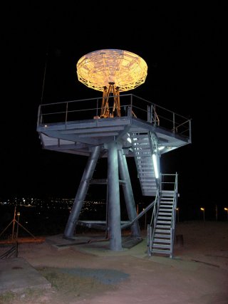
Receiving satellite images already goes back some time in French Guiana. The station in the SEASNET network has been in operation since May 1998. This station seeks to monitor the environment, together with its equivalents in Réunion, New Caledonia, Polynesia, and the Canaries. Each day the IRD receives images from sensors on-board the NOAA (National Oceanic and Atmospheric Administration) and SeaWifs satellites. These are used to produce, for example, maps of surface temperatures and maps of concentrations of chlorophyll.
These two families of satellites make it possible to have an approach to the environment operating at two different scales. For example coastal dynamics may be observed at the level of a municipality using precise images from SPOT and “broad views” of the entire Amazonian zone using the SEASNET station. Soon images will be received by the IRD centre in Cayenne from a third family of satellite – images first from the MERIS hyperspectral sensor onboard the ENVISAT satellite, and then from the TERRA-MODIS satellite will open up new perspectives for the use of satellite imaging.
The IRD wishes to take part in scientific events in French Guiana and involve young Guianese people as much as possible in remote sensing, and so is actively involved in schemes for the public. Each year as part of the Science Fair young schoolchildren in isolated towns and villages are visited by IRD specialists who introduce pupils to technologies far removed from their daily life and environment thanks to appropriate teaching materials.
In November 2008, to celebrate the 3rd anniversary of receiving its first image, SEAS-Guyane organised a conference and brought out an atlas making a series of images seen from the heavens available to the general public.
 Voyages avec Tooy. Histoire, mémoire, imaginaire des Amériques noires : Editions Vents d’ailleurs, 2010
 Guyane. Produits du terroir et recettes traditionnelles. L’inventaire du patrimoine culinaire de la France : Editions Albin Michel, 1999
 Alunawalé, un voyage à travers les milieux naturels de Guyane : Office National des Forêts, 2009
 Augusta Curiel, Fotografe in Suiriname 1904 – 1937 : Libri Misei Surinamensis, 2007
